Can spatial patterns mitigate the urban heat island effect? Evidence from German metropolitan regions
Published in Environment and Planning B: Urban Analytics and City Science, 2024

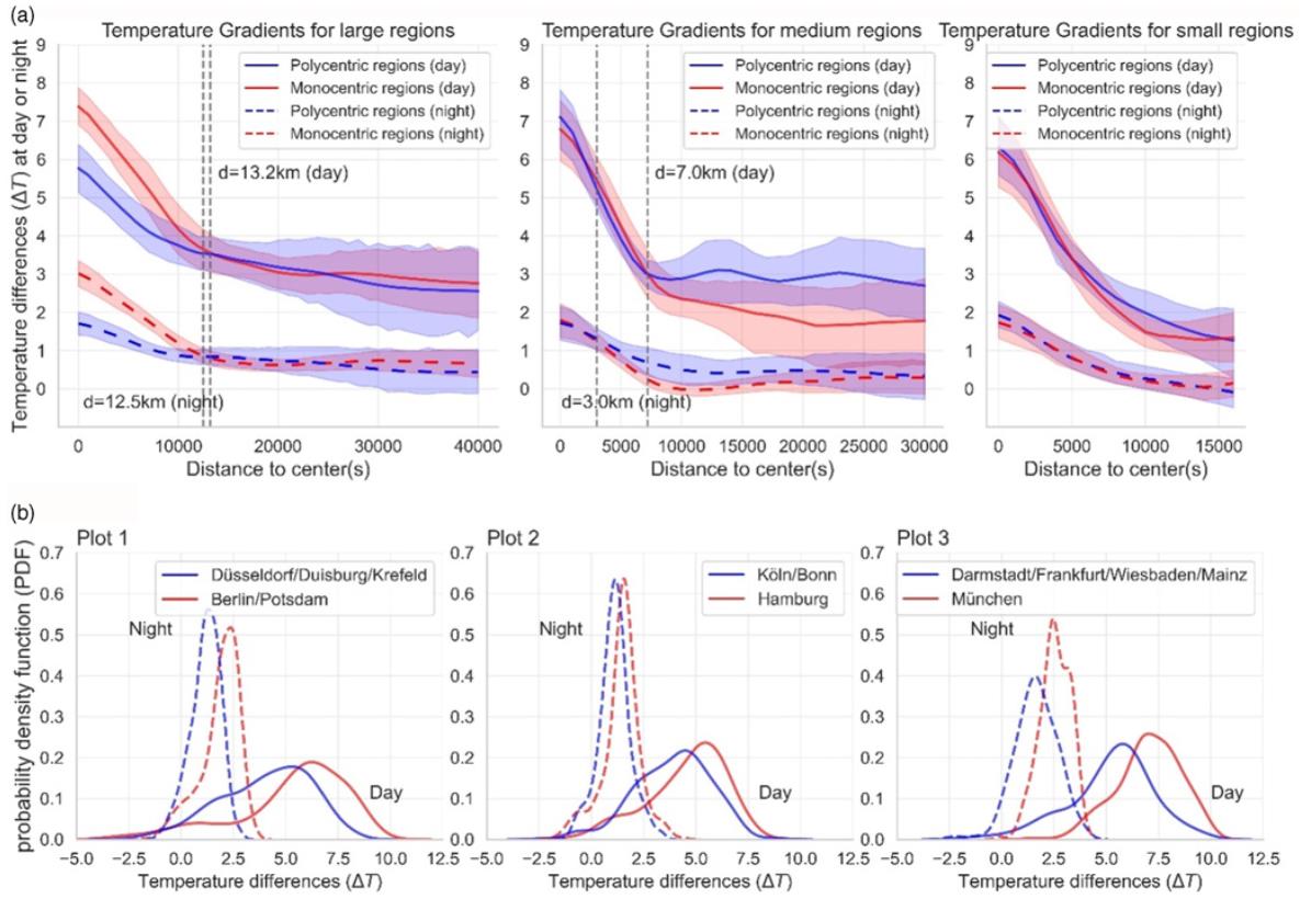
This study examines the efficacy of urban spatial patterns at alleviating the urban heat island (UHI) effect in Germany’s city regions (Großstadtregionen) using multivariate and non-parametric regression methods. Urban spatial patterns are quantified using five landscape metrics that capture the spatial arrangement of urban footprints and greenspaces, along with a polycentricity index that measures the distribution of human activities. The results indicate that certain features of urban fabric, including fragmentation, mixed land use, and regular-shaped urban patches, have the potential to mitigate the UHI effect. Moreover, dispersing multiple smaller greenspaces throughout the urban area demonstrates a greater cooling effect compared to having a single large and more aggregated park. In addition, our analysis reveals that a doubling (100%) of the polycentricity degree corresponds to a significant decrease in both day- and night-time UHI effects, with reductions of 10.4% and 24.6%, respectively. This study confirms that polycentric development yields greater benefits in reducing urban heat for large-sized city regions compared to medium- and small-sized ones; and its effectiveness is mostly pronounced near urban center(s). These findings suggest that polycentric development represents an efficient and feasible strategy for urban thermal planning of large-sized city regions, surpassing other commonly discussed urban configurations, such as compact or dispersed urban development.
Recommended citation: Li, W., & Schmidt, S. (2024). Can spatial patterns mitigate the urban heat island effect? Evidence from German metropolitan regions. Environment and Planning B: Urban Analytics and City Science, 23998083241227500. http://wenzhengli-etal.github.io/files/EPB.pdf
